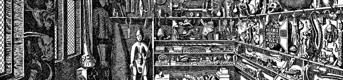
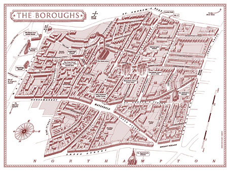
Alan Moore’s magnum opus, Jerusalem, is published today so I can talk at last about my small involvement with this huge novel. The request came through just before Christmas last year: Alan and his publishers, Knockabout Comics, wished to know whether I could create a map for the endpapers of the book. Not a flat street plan, but a bird’s eye view (in isometric or axonometric projection) of the now-demolished area of Northampton known as the Boroughs. The area still exists today under this name but Jerusalem concentrates on the region as it was when Alan was living there as a child: a dense labyrinth of houses, shops and a few small factories dating back to the 19th century, with many older buildings among them. This was the oldest area of the town, having originally grown up around Northampton Castle, a structure that was demolished gradually over the past few hundred years. Some of the street names in the Boroughs recall this history: Castle Street, Fort Street, Moat Street, Castle Terrace, etc.
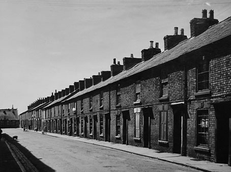
Compton Street a few years before demolition.
I immediately agreed to the request, of course, while swallowing heavily at what I was sure would be a demanding task. Looking at the crude street plan that Tony from Knockabout sent through, and examining the available maps on local history websites, it was evident that this was going to be a difficult technical challenge. Difficult, but not impossible if I could get hold of accurate maps of the area, which is what I did shortly after the Christmas break.
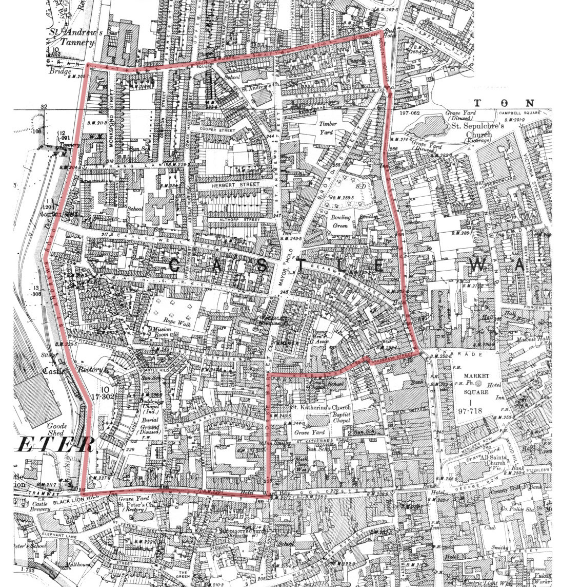
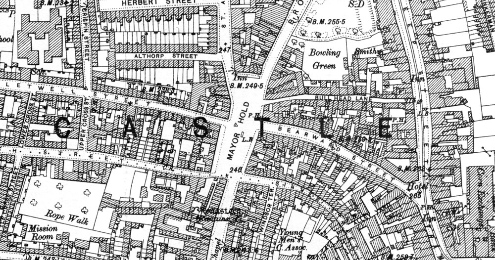
The Boroughs mapped by Ordnance Survey, 1899.
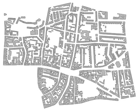
There’s a wonderful publishing company, Alan Godfrey Maps, that specialises in reprinting old Ordnance Survey charts of Britain for use by genealogists and local historians. I’ve had some of their maps of Manchester city centre for years, so I knew they’d be ideal if they covered the relevant area of the town. Fortunately for my purposes, they publish two 1899 25-inch-to-the-mile maps of Northampton town centre which cover the whole of the Boroughs. When the maps arrived I scanned them at high-resolution then stitched them together; the top of the Boroughs extends onto the lower part of the map of northern Northampton. After scanning, it was a case of tracing all the streets and the outline of every single building in the area in order to create a plan that was much more accurate than any of the vague plans available online.
When I began work I had the idea of widening all of the streets in order to have legible street names running along the roads, a common practice among mapmakers who draw city plans. (The map of New York City that Alan and Dave Gibbons used when creating Watchmen is a good example.) However, widening the roads (or diminishing the scale of the buildings) would have risked important landmarks appearing too small, and there were other potential problems looming, so I decided to play safe and keep to the map scale.
The biggest headache after solving the accuracy of the roads and buildings was what to do about the roofs. It wasn’t too difficult to elevate the ground plan once I had it tilted at a suitable angle: the elevation was achieved by making about 12 copies of the ground plan which are stacked one on top of the other. The first layer was run through the bas relief filter in Photoshop in order to give it some depth and shadow. This had the result of shadowing the building walls so they resembled solid three-dimensional blocks when enough layers were stacked together.
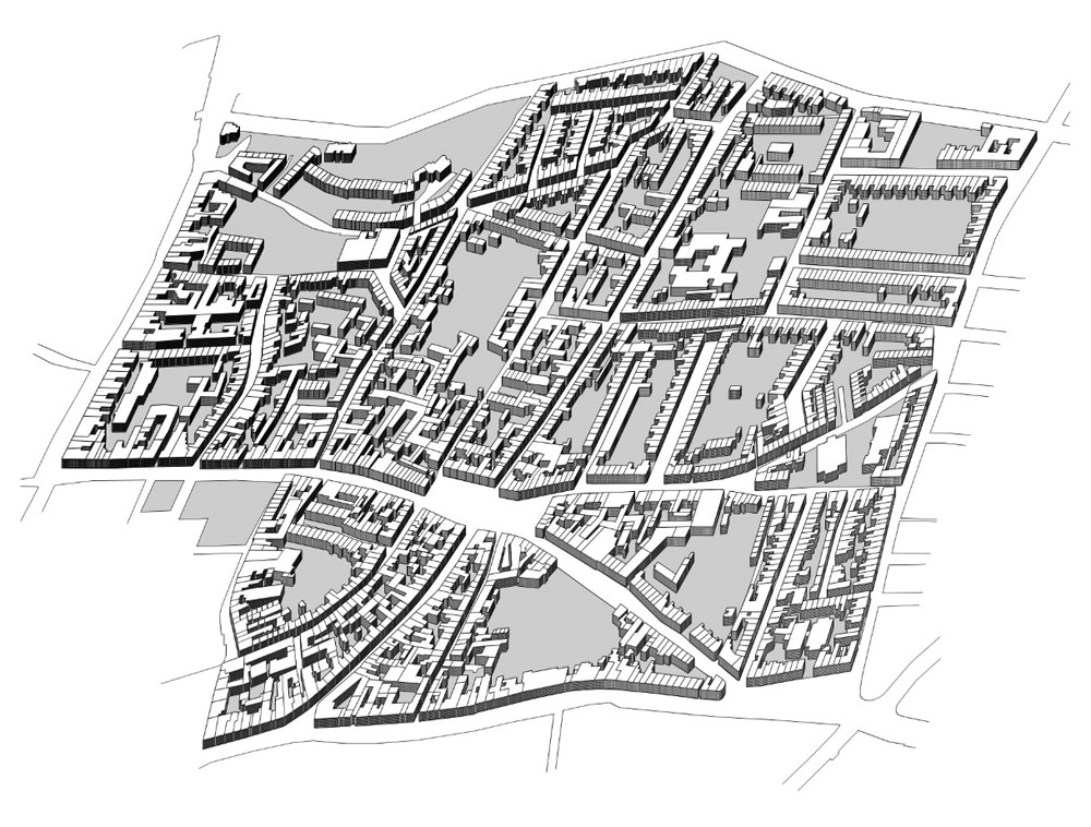
So all the streets and buildings are accurate up to a point. One inaccuracy is that all the buildings except for the churches are the same height, something that was unavoidable without invention. And there’s no representation of the slight hills which raise the streets in places. As for the roofs, these are mostly speculation. I’d thought at first that I might be able to save time by copying and pasting a generic roof shape but the streets are too meandering, and the building plans are too varied. The only solution was to put a copy of the roofless map into Illustrator then draw every single part of every single roof by hand: over 4500 vector pieces in all. By examining Google’s satellite pictures of the undemolished fringes of the old Boroughs I was able to guess how the some of the roofs might have worked together. At the beginning of the novel there’s repeated mention of the word “angles” (and its confusion with “angels”) so it now seems fitting that I spent the best part of a week drawing so many angles on the map. It would have been nice to also put chimneys on each house, and doors and windows (and add fences and pavements…), but if I’d started doing that I’d probably be finishing the work about now. Louis Bretez spent two years drawing the Turgot Map of Paris; I had deadlines pressing so had to get mine finished in five weeks.
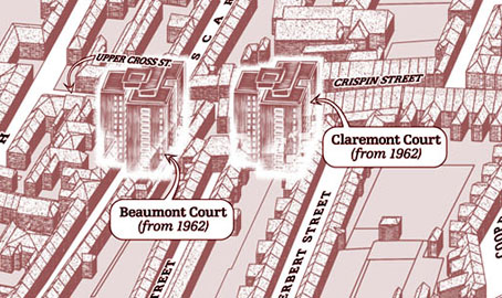
The map is based on the area as it was in 1899 but some of the landmarks are anachronisms. Alan’s story covers the past and present of the area so The Destructor, for example, wasn’t built until the 1920s. This is the building with the smoking chimney, one of several “municipal destructors” (incinerators) built around Britain at the time. The high-rise blocks of Beaumont Court and Claremont Court are even more out-of-time, having been built in 1962. It’s not so obvious from the printed map but these have a slightly ghostly presence since they don’t fit into the streets of the older Boroughs at all. Beaumont Court was built across Scarletwell Street so if you visit the area today you’ll find a block of flats at the end of a street that used to run from the houses where Alan grew up (on St Andrew’s Road) down to the Mayorhold.
A tough assignment, then, but it worked out in the end. It’s been an immense honour being asked to contribute to such a major novel.
Previously on { feuilleton }
• Maps of Midtown Manhattan
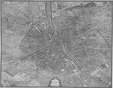
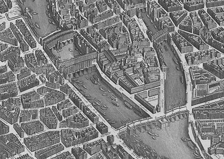
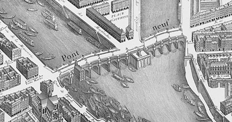
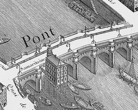
• The Turgot Map of Paris
• Art is magic. Magic is art.
• Alan Moore: Storyteller
• Alan Moore: Tisser l’invisible
• Dodgem Logic #4