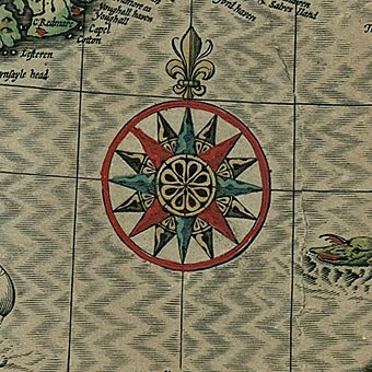
Compass rose by John Speed (1610).
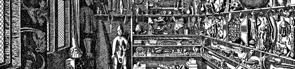
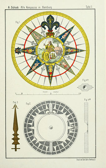
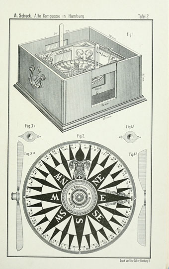
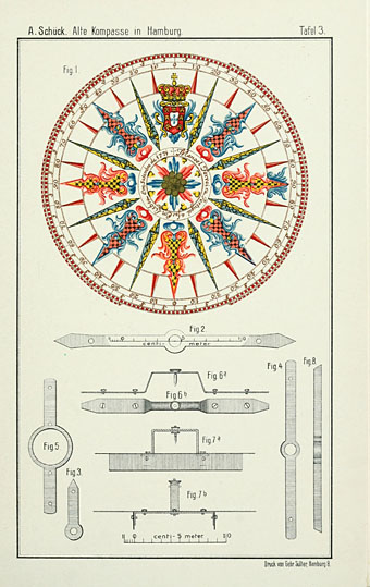
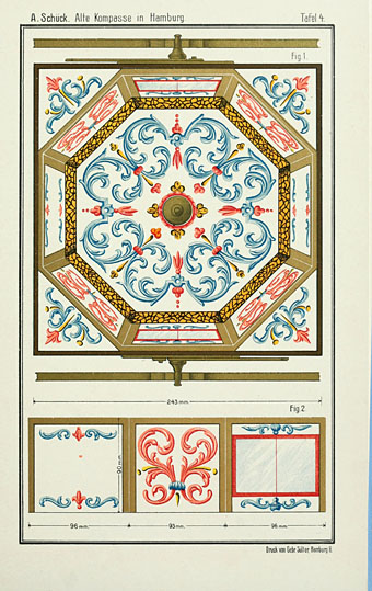
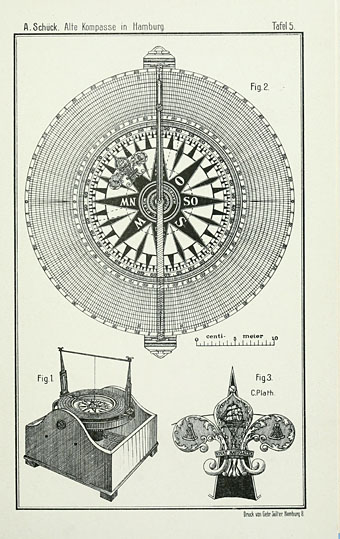
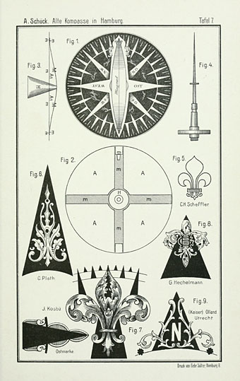
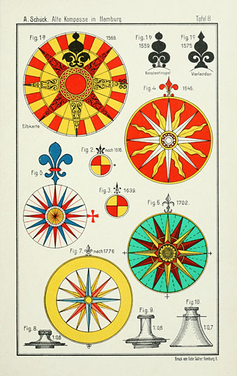
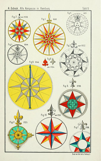
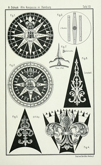
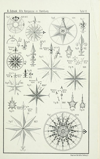
Be still, my beating heart… Every so often this graphic designer has been known to complain that there isn’t a decent resource for those cartographic details known as compass roses. Well today I hit the motherlode with the discovery of Alte Schiffskompasse und Kompassteile im Besitz Hamburger Staatsanstalten (1910) by Albert Schück at the Internet Archive. Schück’s book is a small study of the evolution of the compass card from crude diagram to the elaborate creations seen here, bedizened with astrological figures or divided into degrees. The plates are exactly the kind of thing I’ve been after for years, not that I need them for any particular purpose but—given that I fetishise these things—it’s good to have them to hand.
Part of the obsession can be traced to the compass rose on John Speed’s map of Great Britain and Ireland (above). My teenage bedroom walls included among their pictures a facsimile of Speed’s map printed on some peculiar plasticised paper which (as I recall) was supposed to make it look an antique print. When drawing maps of my own I’d usually copy Speed’s compass rose, and familiarity with the device meant that I started searching them out whenever I saw another old map. Also on the bedroom wall was Pauline Baynes’ map of Middle Earth which includes a compass rose of its own.
BibliOdyssey posted a nice selection of Speed maps recently, all of them hand-coloured (my reproduction was black-and-white). Speed’s compass rose for the Isle of Man makes the island appear to be the centre of the world. Also at the Internet Archive is a similar study to the Schück, The Rose of the Winds: The origin and development of the Compass-Card (1913) by Silvanus P Thompson. This is more useful if your interest is in the actual history of the cards since the diagrams are a lot less extravagant. Among other things Thompson refers to Schück’s volume in a note about the origin of the fleur-de-lys figure as a compass fixture. “Rose of the Winds” refers to the very earliest compass devices in which directions were marked not with North, South, East and West but with whatever the local names were for the winds at sea.
Previously on { feuilleton }
• Pauline Baynes, 1922–2008
• Imaginary maps by Francesca Berrini
Some nice compass roses in the Portalan Chart collection at Yale’s Beinecke Library:
http://beinecke.library.yale.edu/digitalguides/portolan.html
Reminds me looking at the beautiful maps in the Vatican museum – they have gorgeous roses too ( like this one )
The Ninety-Nines (the international women pilots organization) uses a compass rose as a central image in their logo/letterhead/watermark/etc. They also paint compass roses on airport tarmacs all over the United States each summer as service projects for the airports. The Colorado chapter just did one last June here in Denver at Centennial Airport. The group calls these events “airmarkings”. They always welcome volunteers (!). And, the compass roses are semi-temporary — you know, as long as the paint stands up to the vagaries of weather and sunshine. Also, as magnetic variation changes over time, magnetic north will change and subsequent compass roses will “shift” a bit.
http://www.ninety-nines.org/index.cfm/air_marking.htm
They’ve installed a more stylized, permanent type of tile compass rose at their headquarters in Oklahoma City, OK.
http://www.ninety-nines.org/index.cfm/compass_rose.htm
Thanks, everyone.
Nathalie: If I hadn’t just read about the Rose of the Winds I’d be wondering what the painted letters were.
Anna: That’s fascinating, I’d not heard of the group before.
Like you, only possibly a few years earlier, the 1960’s – I too grew up with a John Speed map (of Cornwall with compass rose and sea monsters) and the Baynes map of Middle Earth on my bedroom walls. My uncle purchased the map from a shop in London – Arthur Reader, 71 Charing Cross Road – when he was in the Foreign Service. I think he choose Cornwall because his and my father’s side of the family supposedly come from there…both maps kind of served as bridges to imaginary places where I could escape the otherwise painful years of high school and adolescence in the suburbs of Atlanta, Georgia. I still have the map of Cornwall; the map of Middle Earth was destroyed in a much regretted fit of embarrassment…”What you still read Tolkien?” I enjoy feuilleton probably more than any other site I’ve encountered – we are in some ways on the same wave length – obviously men with great taste – if that’s not too embarrasing!
Hi John, and thanks. I also got rid of my Middle Earth map out of embarrassment, then later regretted it since I did like Pauline Baynes’ artwork. A silly reaction, really, although I think mine had also got badly torn so it seemed best to throw it out.
Crazy ! I was looking for compass roses earlier today… Great post, as always !