
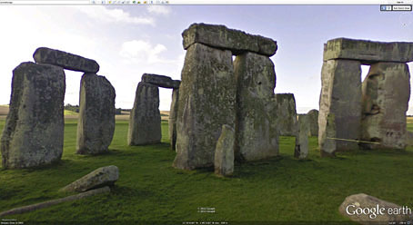
The trilithons of Stonehenge as they appear in Google Earth, a view that few people these days are allowed to experience since visitors are kept to a small path that runs around the monument. Thirty years ago this week, on the day of the Summer Solstice, I was fortunate to be present at the small Stonehenge Free Festival that was taking place in a field across the road. English Heritage always opened up the stones for the Solstice so I got to stand in the centre of the circle and watch a couple of improvised hippie weddings taking place. (Every now and then I wonder whether those couples are still together.) The festival had been staged annually since 1972 and, unlike the walled and ticketed Glastonbury Festival, was a thoroughly anarchist affair: people simply turned up, stayed for a week or so then left. That changed in 1985 when someone at English Heritage decided that the festival wasn’t going to happen; police cordoned off the area and the resulting conflict put an end to the festival for good.
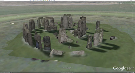
One of Google Earth’s army of diligent model-makers, Tom Harvey, is responsible for the 3D view of the stones. These work better than many of the 3D buildings in Google Earth which often look painfully isolated in otherwise flattened cityscapes. Stonehenge also suits this treatment better than most of Britain’s other ancient monuments which tend to be smaller stone circles or mounds of earth. There is a Silbury Hill but nothing for nearby Avebury as yet.
Previously on { feuilleton }
• Stonehenge panorama
• Born again pagans
Man, knowing if those hippie couples are still together would be one hell of a story for me to run in the newspaper I work, if I was in England…